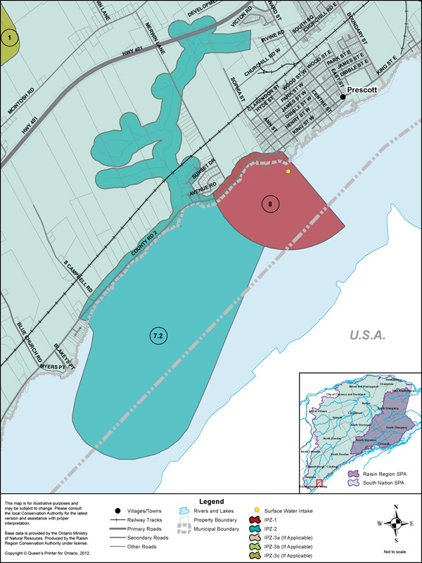
The Town of Prescott municipal water intake is located to the west of the Town limits at the foot of Sophia St., in the St. Lawrence River. Raw water is drawn from approximately 2.3 m off the river bottom. The normal depth of water over the intake is estimated to be about 5.5 m. The intake crib is approximately 105 m from the shore. The Ontario Clean Water Agency operates the Prescott Water Treatment Plant which services approximately 3,900 residents who live in Prescott and a small portion of Edwardsburgh/Cardinal.
Vulnerability Scoring
The vulnerability score is a representative measure of the drinking water source's susceptibility to contamination due to the nearby physical landscape (ratio of land to water in the area, land cover, soil type, and hydrological and hydrogeological conditions in the area) and the physical conditions at the intake (depth of the intake, distance from land, past drinking water issues).
Higher values indicate a higher level of concern for contamination. Intake Protection Zones (IPZs) are the areas where policies may apply to protect drinking water sources. IPZ-1 is the zone immediately near the intake. IPZ-2 is an area based on the response time required to react to a reported spill.
| Zone | Vulnerability Score |
|---|---|
| IPZ-1 | 8 |
| IPZ-2 | 7.2 |
Source Protection Policies
The following activities if occurring in a vulnerable area near the drinking water source could be a significant drinking water threat*:
- Application of Septage
- Sewage Works
- Agricultural Activities
- Chemicals
* Please consult the Source Protection Authority or the Risk Management Official to determine the exact circumstances, and locations where source protection policies apply near this drinking water source.