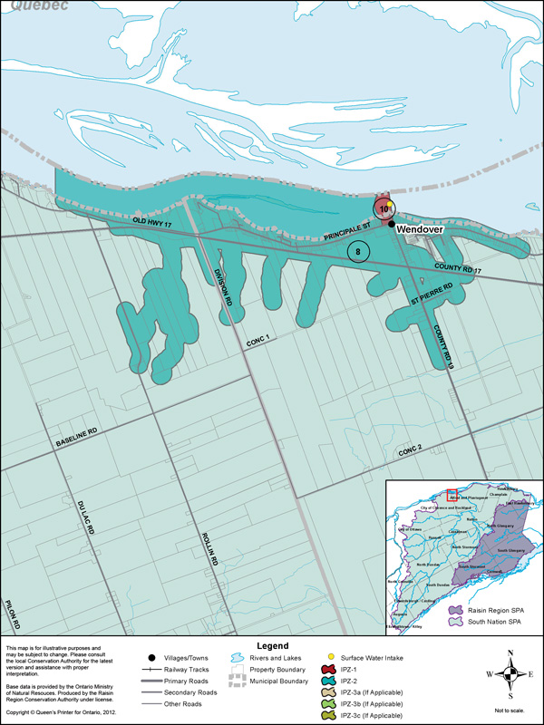
Owned by the Township of Alfred-Plantagenet and operated by the Ontario Clean Water Agency (OCWA), the Wendover Water Treatment Plant draws its water from the Ottawa River. The intake is located on Highway 17 in Wendover, north of the Wendover Water Treatment Plant, approximately 100 m off shore at a depth of 4 m. The system serves a population of approximately 850 residents. This drinking water system is one of 13 systems that draw water from surface water in the form of rivers or lakes in the Raisin-South Nation Source Protection Region.
Vulnerability Scoring
The vulnerability score is a representative measure of the drinking water source's susceptibility to contamination due to the nearby physical landscape (ratio of land to water in the area, land cover, soil type, and hydrological and hydrogeological conditions in the area) and the physical conditions at the intake (depth of the intake, distance from land, past drinking water issues).
Higher values indicate a higher level of concern for contamination. Intake Protection Zones (IPZs) are the areas where policies may apply to protect drinking water sources. IPZ-1 is the zone immediately near the intake. IPZ-2 is an area based on the response time required to react to a reported spill.
| Zone | Vulnerability Score |
|---|---|
| IPZ-1 | 10 |
| IPZ-2 | 8 |
Source Protection Policies
The following activities if occurring in a vulnerable area near the drinking water source could be a significant drinking water threat*:
- Waste Disposal Sites
- Sewage Works
- Agricultural Activities
- Pesticides
- Salt and Snow
- Fuel
- Chemicals
* Please consult the Source Protection Authority or the Risk Management Official to determine the exact circumstances, and locations where source protection policies apply near this drinking water source.