The City of Cornwall of Cornwall's municipal water supply is taken from a small lake feature, within the St. Lawrence River (Lake St. Lawrence). The intake is located in the west face of the RH Saunders Dam, within the Cornwall Dyke closure structure on north side of the dam. The depth of the water over the intake is 15 m. Raw water is piped from the intake by a gravity fed main to the water purification plant, located 3km east of the intake. Owned and operated by the City of Cornwall, the Cornwall Water Treatment Plant currently serves a population of over 47,000 residents and includes service to the communities of Rosedale Terrace and St. Andrew's West.
Vulnerability Scoring
The vulnerability score is a representative measure of the drinking water source's susceptibility to contamination due to the nearby physical landscape (ratio of land to water in the area, land cover, soil type, and hydrological and hydrogeological conditions in the area) and the physical conditions at the intake (depth of the intake, distance from land, past drinking water issues).
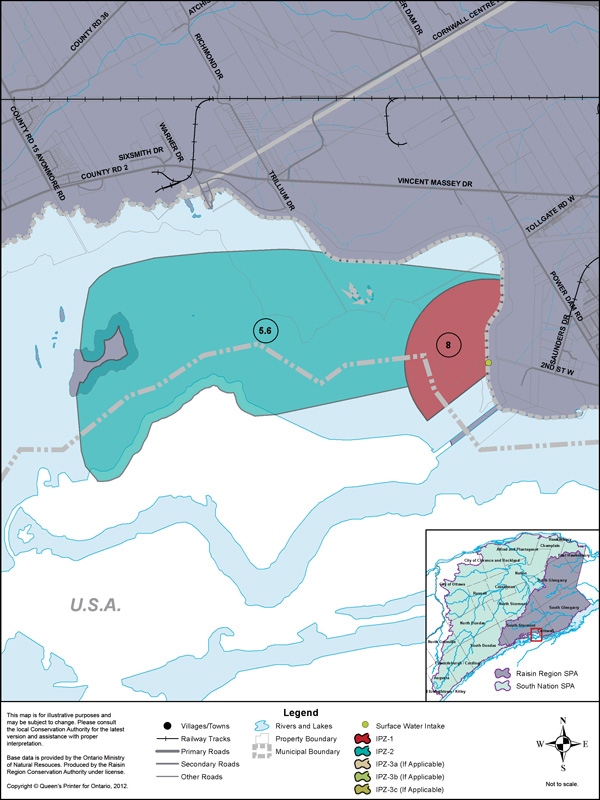
Higher values indicate a higher level of concern for contamination. Intake Protection Zones (IPZs) are the areas where policies may apply to protect drinking water sources. IPZ-1 is the zone immediately near the intake. IPZ-2 is an area based on the response time required to react to a reported spill.
| Zone | Vulnerability Score |
|---|---|
| IPZ-1 | 8 |
| IPZ-2 | 5.6 |
Source Protection Policies
The following activities if occurring in a vulnerable area near the drinking water source could be a significant drinking water threat*:
- Application of Septage
- Sewage Works
- Agricultural Activities
- Chemicals
* Please consult the Source Protection Authority or the Risk Management Official to determine the exact circumstances, and locations where source protection policies apply near this drinking water source.